Fairfax County General :
Fairfax Underground

Welcome to Fairfax Underground, a project site designed to improve communication among residents of Fairfax County, VA. Feel free to post anything Northern Virginia residents would find interesting.
Welcome to Fairfax Underground, a project site designed to improve communication among residents of Fairfax County, VA. Feel free to post anything Northern Virginia residents would find interesting.
Flooding! [theres a river where my backyard should be]
Posted by:
Cary
()
Date: June 26, 2006 04:13AM
edit: Merged this thread with p2dak18's "theres a river where my backyard should be"
Last night brought some of the worst flooding I've seen in the 18 years I've lived in western Fairfax. 495 was shut down both ways, route 50 in front of Fair Oaks mall was under water, and large sections of the City of Fairfax had to be blocked.
I decided to be a dork and go to a few local places near my house that are prone to flooding.
You can click any of the thumbnails to bring up the HUGE full-size originals. These thumbnails have been lightened slightly with The Gimp.
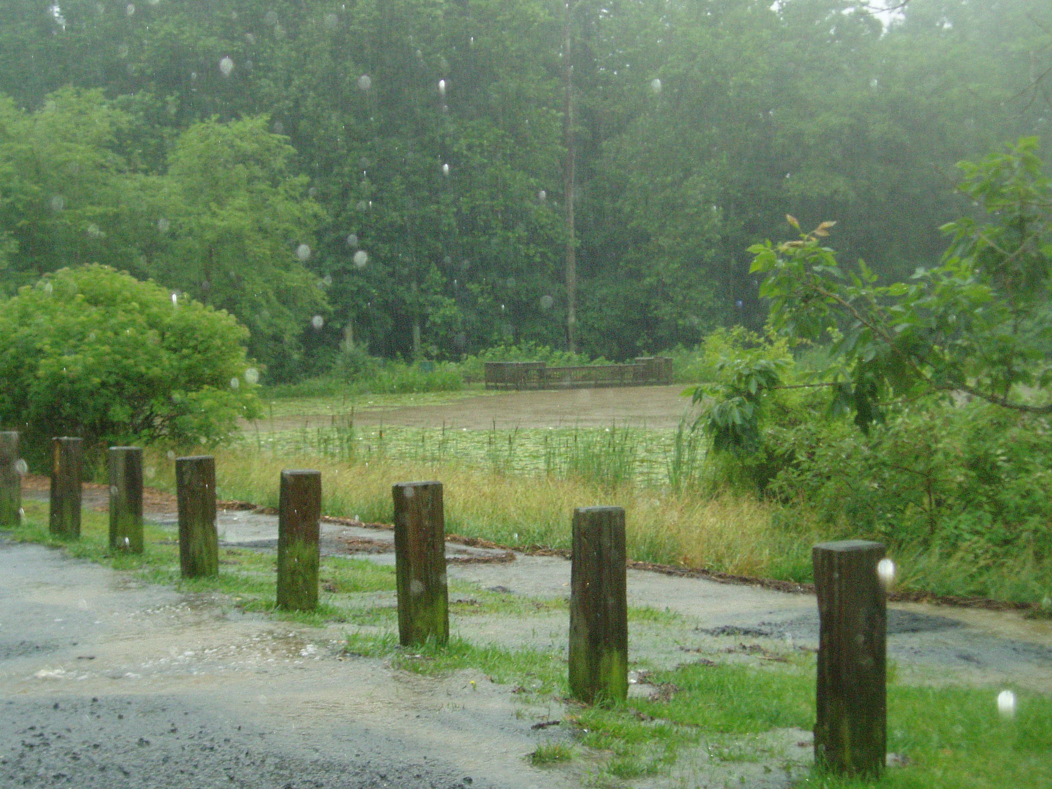
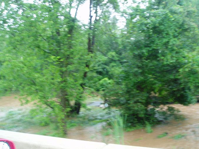
This first shot was taken 2 days ago (6/23 1:52am) at the stepping stones behind Walney Oaks on the trail that connects to the Waverly Crossing Bike Path. Usually you can bike or even rollerblade through here without a problem. This picture shows the creek at a "normal" flood stage.
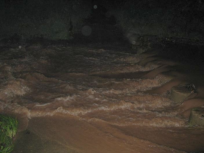
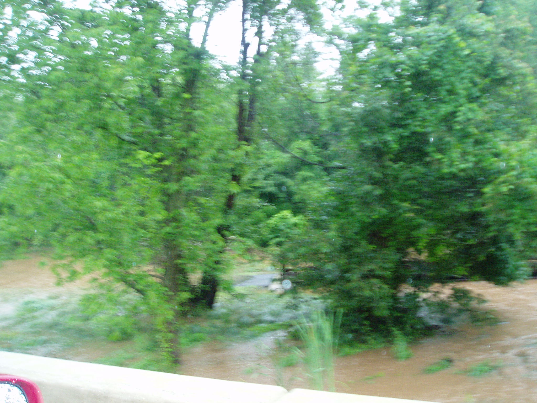
And this was the scene last night. Note that you can't even see the impressions of the stepping stones in the water. I was also a good 10 feet farther back for this shot.
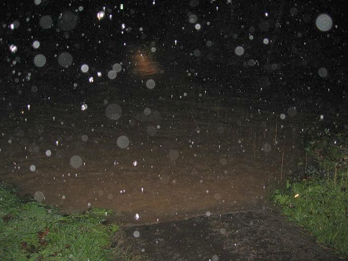
A shot of the bridge that runs over Big Rocky Run behind Poplar Tree Elementary. Usually this bridge is a 6 foot drop to a bubbling little creek beneath.
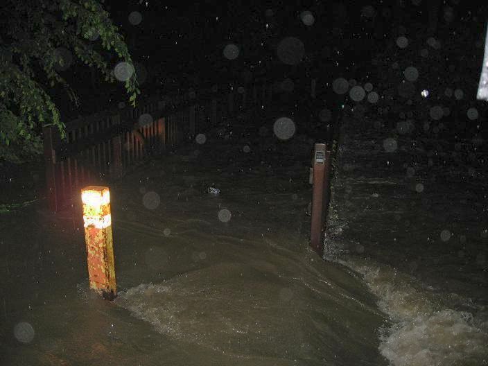
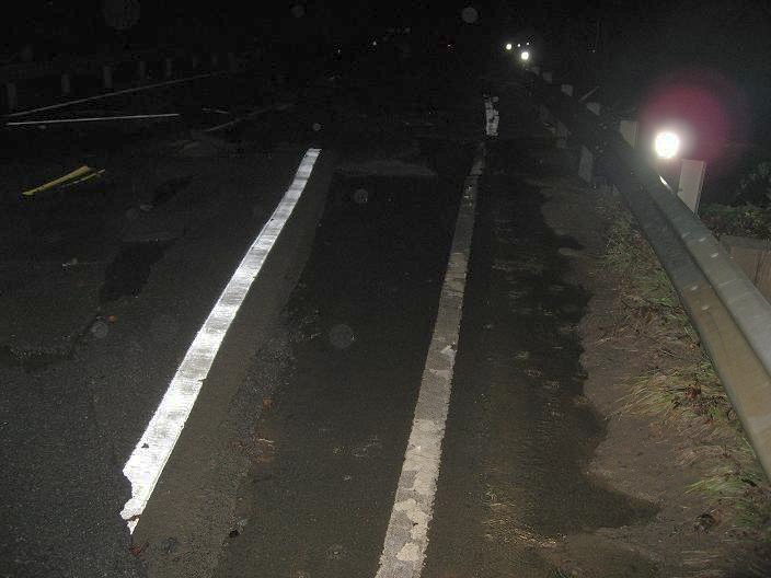
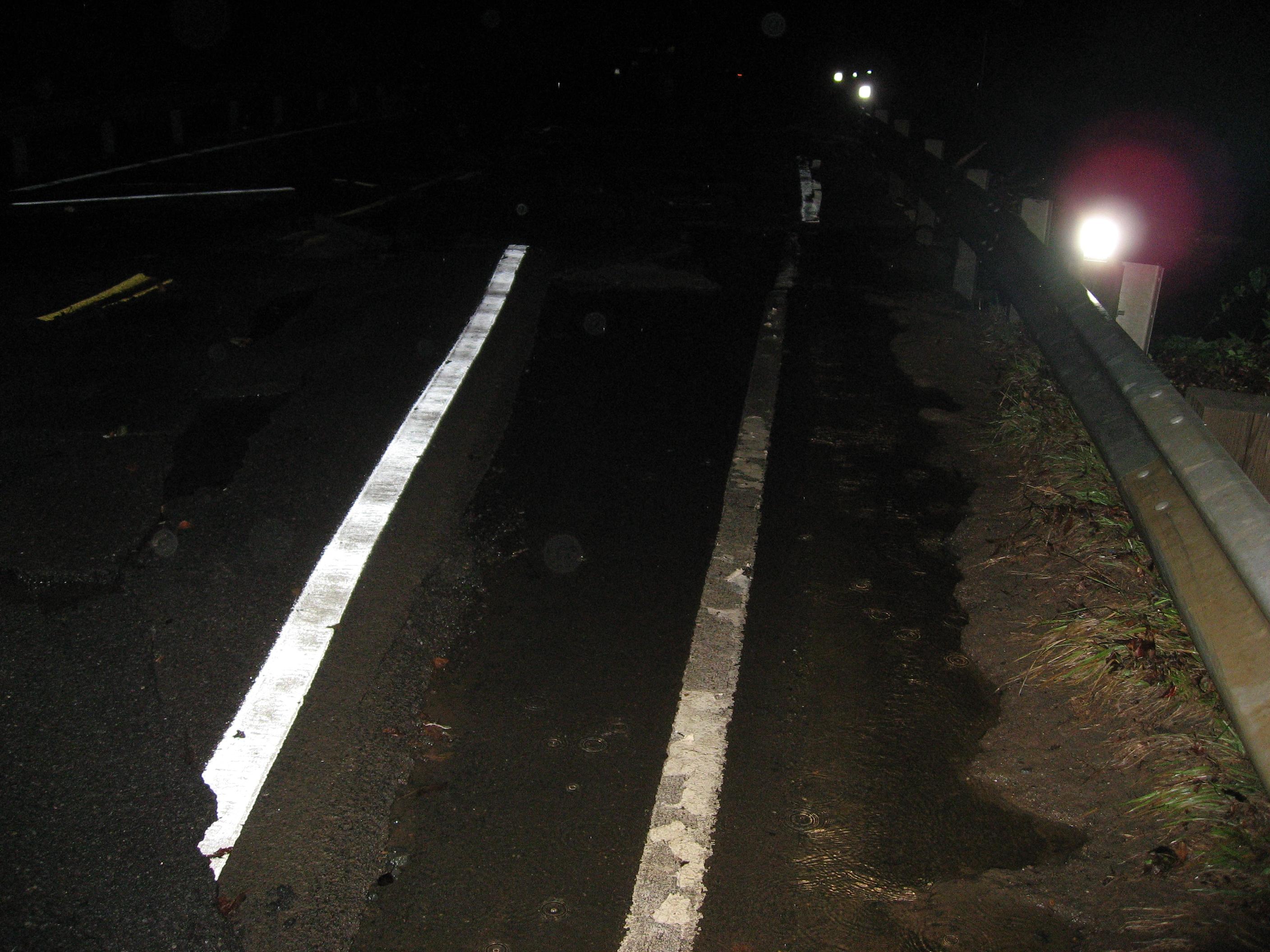
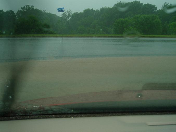
The low-point of Walney Road by the intersection with Westfields Blvd was completely destroyed with flood waters tearing apart layers of asphalt on the bridge.
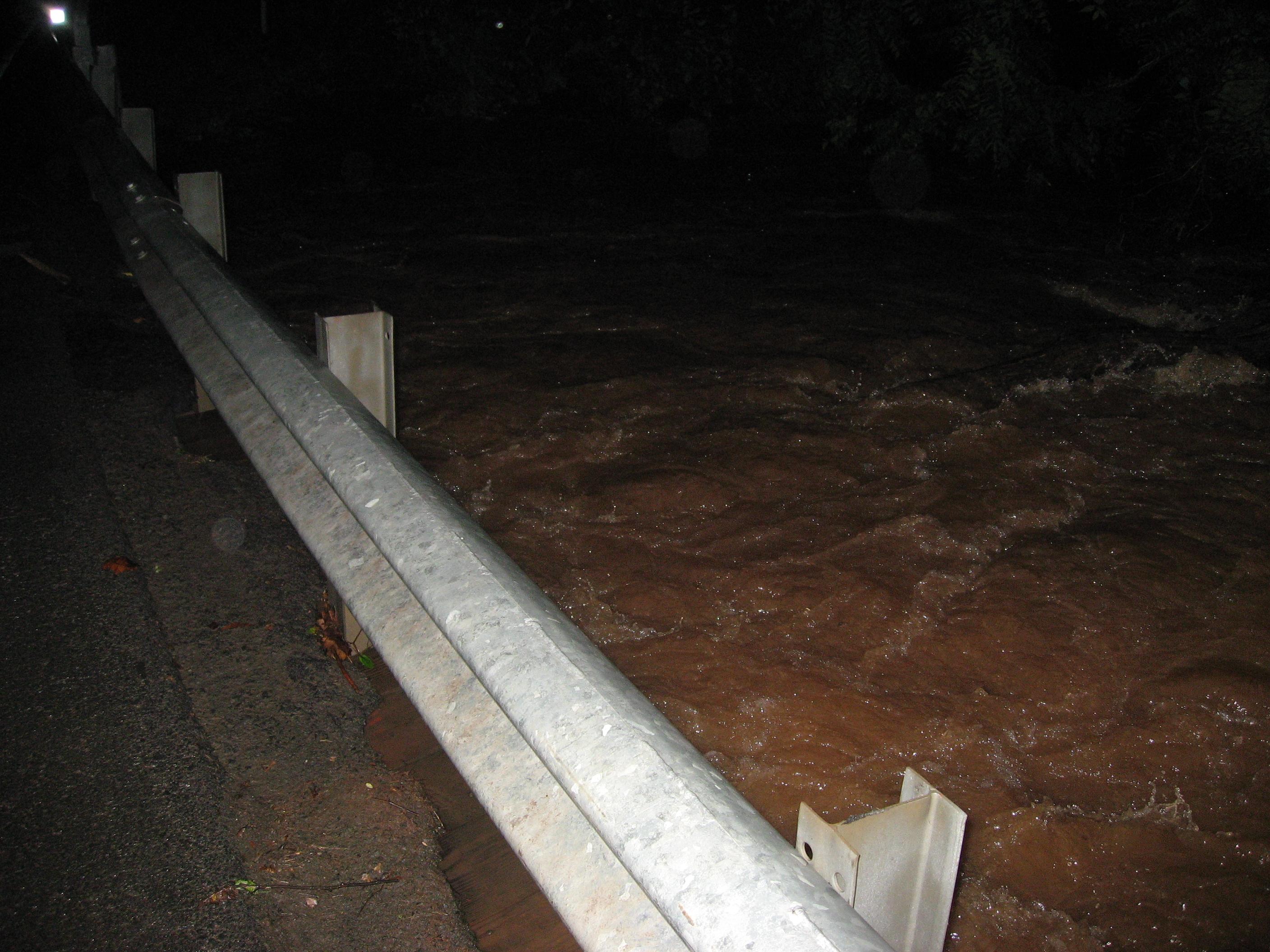
Flood waters rushing underneath the bridge on Walney Road.
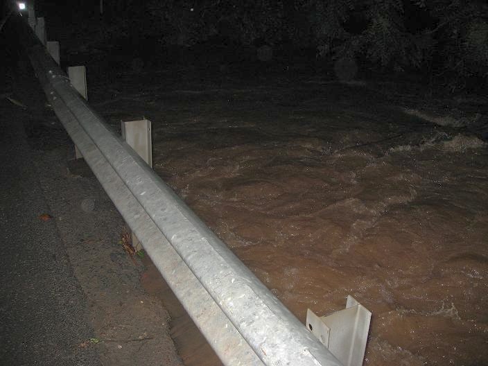
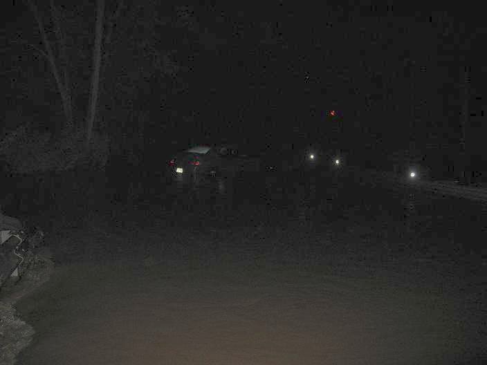
I was only able to stand where I did to take these pictures because something collapsed sending the flood waters over Walney Rd 50 feet closer to the Expo Center than the usual high water point. A car got stuck in the water at this "new" river-crossing and the occupants had to be rescued.
Anyone else have pictures of the flooding?
Edited 1 time(s). Last edit at 06/26/2006 05:59PM by Cary.
Last night brought some of the worst flooding I've seen in the 18 years I've lived in western Fairfax. 495 was shut down both ways, route 50 in front of Fair Oaks mall was under water, and large sections of the City of Fairfax had to be blocked.
I decided to be a dork and go to a few local places near my house that are prone to flooding.
You can click any of the thumbnails to bring up the HUGE full-size originals. These thumbnails have been lightened slightly with The Gimp.
This first shot was taken 2 days ago (6/23 1:52am) at the stepping stones behind Walney Oaks on the trail that connects to the Waverly Crossing Bike Path. Usually you can bike or even rollerblade through here without a problem. This picture shows the creek at a "normal" flood stage.
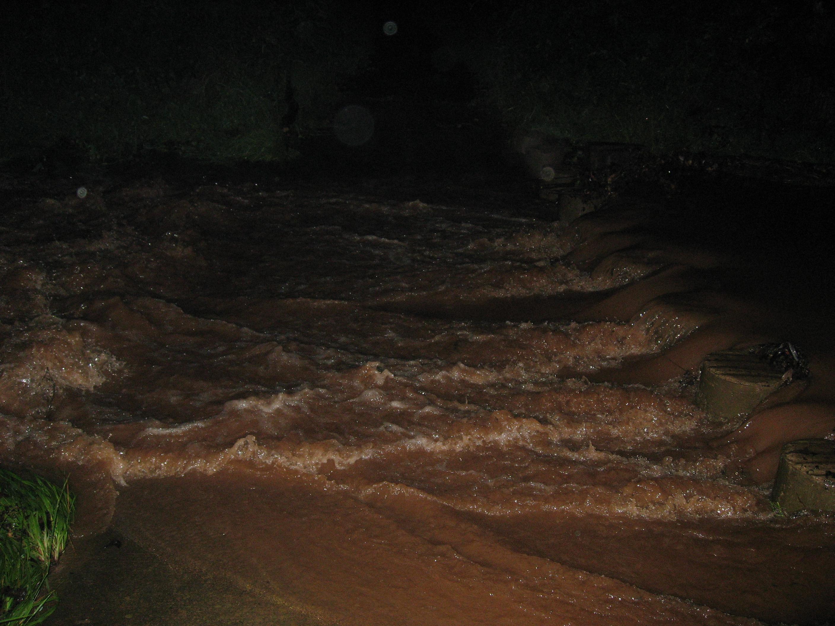
And this was the scene last night. Note that you can't even see the impressions of the stepping stones in the water. I was also a good 10 feet farther back for this shot.
A shot of the bridge that runs over Big Rocky Run behind Poplar Tree Elementary. Usually this bridge is a 6 foot drop to a bubbling little creek beneath.
The low-point of Walney Road by the intersection with Westfields Blvd was completely destroyed with flood waters tearing apart layers of asphalt on the bridge.
Flood waters rushing underneath the bridge on Walney Road.
I was only able to stand where I did to take these pictures because something collapsed sending the flood waters over Walney Rd 50 feet closer to the Expo Center than the usual high water point. A car got stuck in the water at this "new" river-crossing and the occupants had to be rescued.

Anyone else have pictures of the flooding?
Edited 1 time(s). Last edit at 06/26/2006 05:59PM by Cary.
Re: Flooding
Posted by:
Gravis
()
Date: June 26, 2006 04:41AM
all the fools that try to drive through flood waters deserve what they get. oh yes, it really doesnt flood where i am... the curbs become small rivers though. drainage system is good here.
on a side note, gimp has a horrifically bad user interface and i do everything i can to avoid having to use it. hell, ill pirate photoshop 5.5 if i must.
"the wisdom of the wise will perish, the intelligence of the intelligent will vanish."
on a side note, gimp has a horrifically bad user interface and i do everything i can to avoid having to use it. hell, ill pirate photoshop 5.5 if i must.
"the wisdom of the wise will perish, the intelligence of the intelligent will vanish."
Re: Flooding
Posted by:
KeepOnTruckin
()
Date: June 26, 2006 04:20PM
I took a picture with my phone, can't quite upload it, will soon. I was on Compton Rd today (BAD IDEA) The bridge over LRR is flooded over. I ran down LRR about 0.5 a mile to the intersection with Bull Run (see pic here ) and the stepping stones were covered over. Just before the sewage plant as well. I turned around at both. At the latter a firetruck drove behind me and blocked it off. There is a low place just before it and Sharpsburg(sp) Lane after NOVEC substation. It was about 3 feet deep (fire hydrant barely visible) I ran down LRR about 0.5 a mile to the intersection with Bull Run (see pic here ) and the stepping stones were covered over.
edit by cary: fixed html
Edited 1 time(s). Last edit at 06/26/2006 05:29PM by Cary.
edit by cary: fixed html
Edited 1 time(s). Last edit at 06/26/2006 05:29PM by Cary.
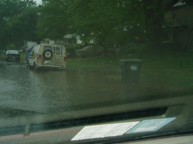
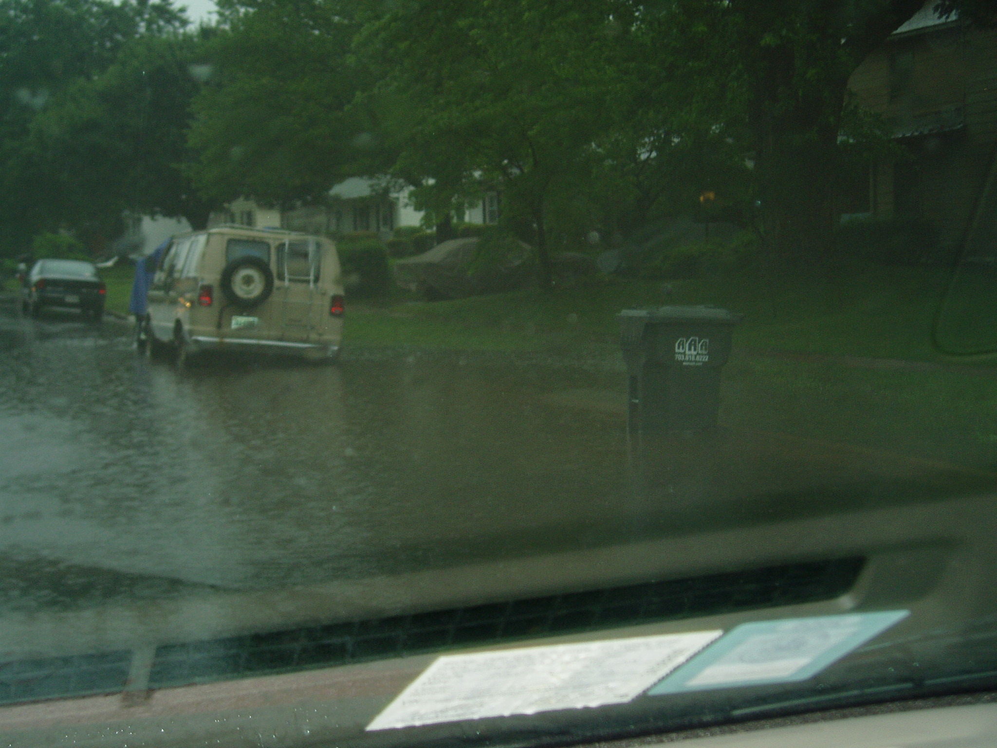
theres a river where my backyard should be
Posted by:
p2dak18
()
Date: June 26, 2006 04:26PM
Walney pond/road = Walney LAKE
edit by cary: made thumbnails of images. click for full-size originals

Edited 1 time(s). Last edit at 06/26/2006 06:12PM by Cary.
edit by cary: made thumbnails of images. click for full-size originals


Edited 1 time(s). Last edit at 06/26/2006 06:12PM by Cary.
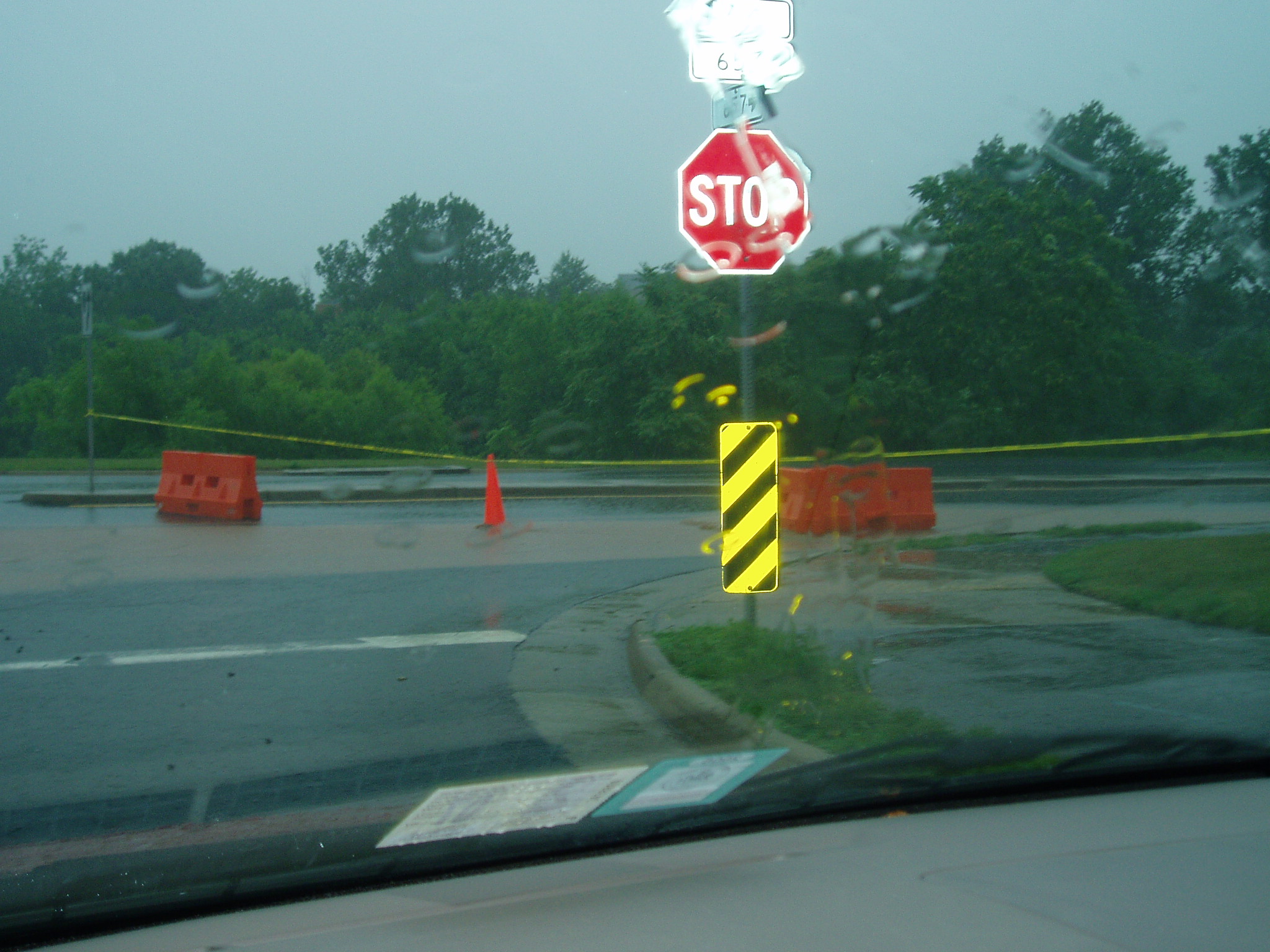
Re: theres a river where my backyard should be
Posted by:
p2dak18
()
Date: June 26, 2006 04:31PM
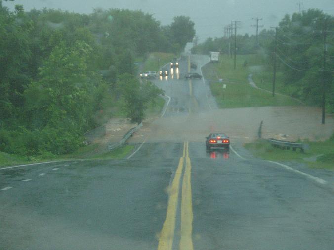
Roads closed and neighborhood flooding
edit by cary: made thumbnails of images. click for full-size originals
Edited 1 time(s). Last edit at 06/26/2006 06:15PM by Cary.
edit by cary: made thumbnails of images. click for full-size originals

Edited 1 time(s). Last edit at 06/26/2006 06:15PM by Cary.
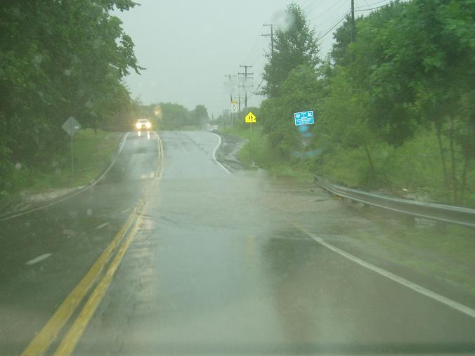
Re: theres a river where my backyard should be
Posted by:
p2dak18
()
Date: June 26, 2006 04:33PM
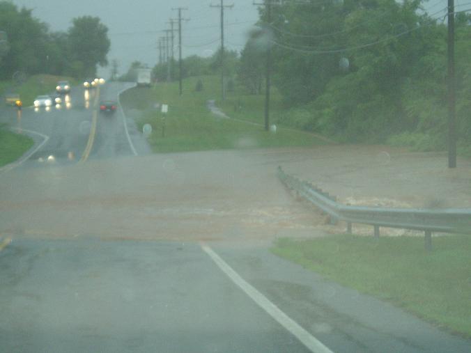
The road near Franklin Farm Middle School
edit by cary: made thumbnails of images. click for full-size originals. the street here is lees corner road.
Edited 2 time(s). Last edit at 06/26/2006 06:18PM by Cary.
edit by cary: made thumbnails of images. click for full-size originals. the street here is lees corner road.


Edited 2 time(s). Last edit at 06/26/2006 06:18PM by Cary.
Re: theres a river where my backyard should be
Posted by:
p2dak18
()
Date: June 26, 2006 04:35PM
Braddock Rd Bridge on the way the Cox Farm
edit by cary: made thumbnails of images. click for full-size originals.
Edited 1 time(s). Last edit at 06/26/2006 06:19PM by Cary.
edit by cary: made thumbnails of images. click for full-size originals.


Edited 1 time(s). Last edit at 06/26/2006 06:19PM by Cary.
Re: theres a river where my backyard should be
Posted by:
p2dak18
()
Date: June 26, 2006 04:35PM
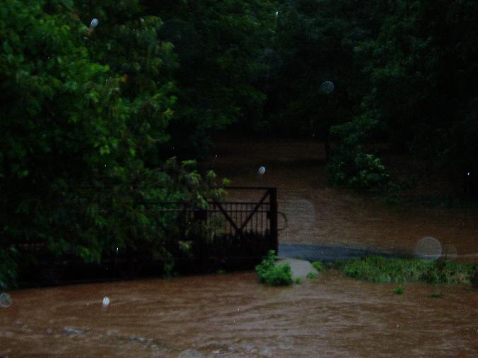
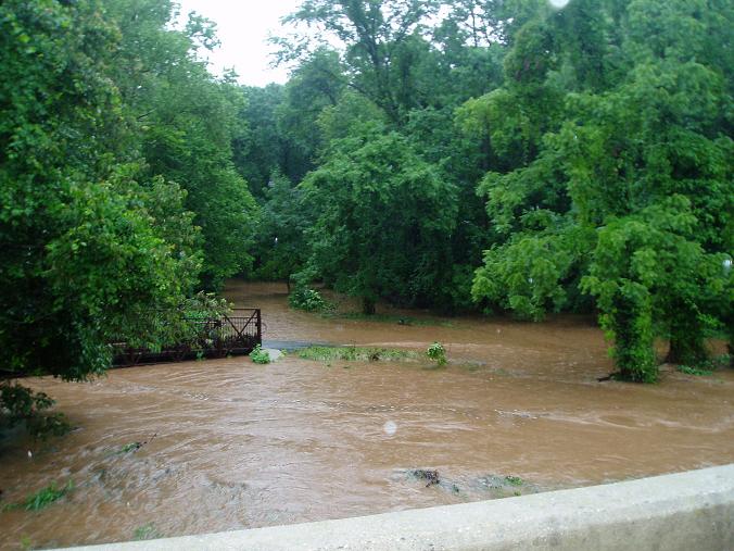
My back yard
edit by cary: made image a thubmail. click it for the full-size original.
Edited 1 time(s). Last edit at 06/26/2006 06:20PM by Cary.
edit by cary: made image a thubmail. click it for the full-size original.
Edited 1 time(s). Last edit at 06/26/2006 06:20PM by Cary.
Re: theres a river where my backyard should be
Posted by:
KeepOnTruckin
()
Date: June 26, 2006 04:38PM
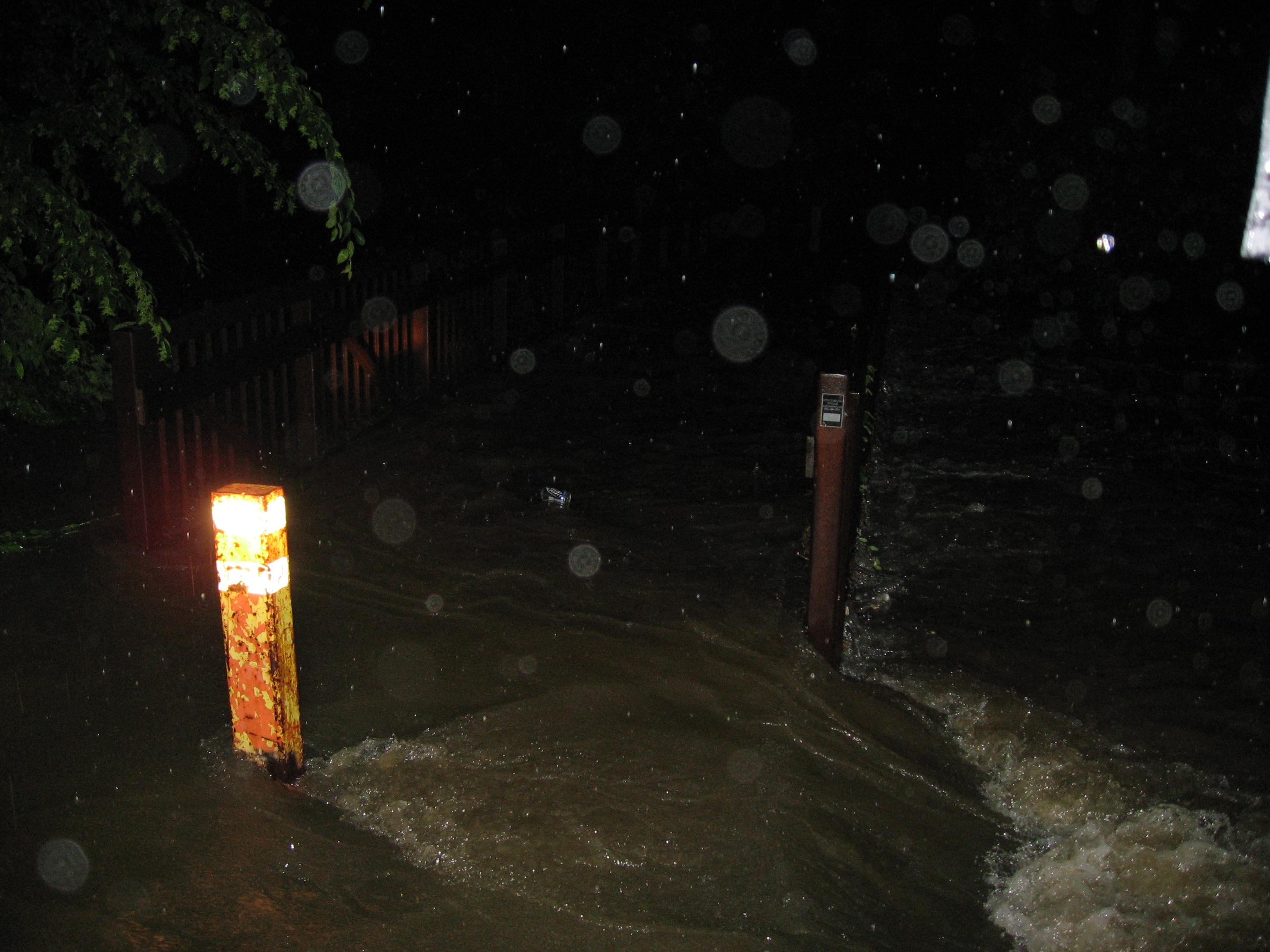
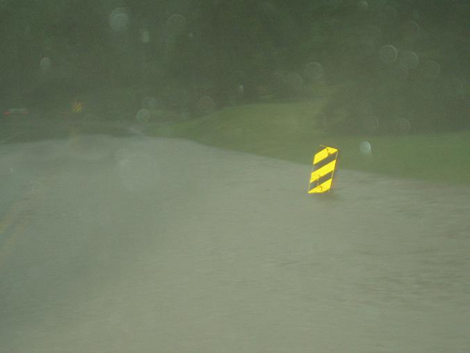
How abou the section of walney where there is the signs marking feet (they're yellow, narrow, tall, 5 ft)
Re: Flooding! [theres a river where my backyard should be]
Posted by:
Cary
()
Date: June 26, 2006 06:31PM
p2dak,
Wow great pictures! thanks! I should follow your lead and take my pictures during the day when you can actually see something! I've merged our threads together, hope you don't mind.
KeepOnTruckin,
My picture of the road all torn up IS that section of walney where the yellow flood signs are. The river forged a new path over a slightly lower point so the signs are now in the wrong spot.
MrDoctor,
Yeah rain can fuck the camera up, but it wasn't raining that hard anymore when I went out to take the pictures. And I brought along a zip-loc baggie to keep it in.
Re: Flooding! [theres a river where my backyard should be]
Posted by:
p2dak18
()
Date: June 26, 2006 07:27PM
no problem here, great idea
Re: Flooding! [theres a river where my backyard should be]
Posted by:
photographer
()
Date: June 27, 2006 08:04PM
Very impressive flooding. I have serveral non-digital photos that i will scan and upload here once I get them developed. Great shots guys!
Re: Flooding! [theres a river where my backyard should be]
Posted by:
KeepOnTruckin
()
Date: June 27, 2006 08:22PM
I just got all it all hooked up to transfer the pics from my phone, and the damn computer crashes. I had several pics of LRR and also some cops blocking off Rt 29 at Stringfellow as well as Compton Rd.
Re: Flooding! [theres a river where my backyard should be]
Posted by:
Gravis
()
Date: June 28, 2006 01:00AM
KeepOnTruckin Wrote:
-------------------------------------------------------
> I just got all it all hooked up to transfer the
> pics from my phone, and the damn computer crashes.
sounds like a windows problem. ;)
"the wisdom of the wise will perish, the intelligence of the intelligent will vanish."
-------------------------------------------------------
> I just got all it all hooked up to transfer the
> pics from my phone, and the damn computer crashes.
sounds like a windows problem. ;)
"the wisdom of the wise will perish, the intelligence of the intelligent will vanish."
Re: Flooding! [theres a river where my backyard should be]
Posted by:
345
()
Date: June 28, 2006 12:05PM
I saw the Beer Looter dude crossing FFX pkwy with a case of Heinekens
Re: Flooding! [theres a river where my backyard should be]
Posted by:
michelle
()
Date: June 28, 2006 12:11PM
I drove through flood waters yesterday. The trick is to get a good to 88mph heading into it, so that you have enough velocity to make it to the other side without stalling in the middle of the flooded street.
Re: Flooding! [theres a river where my backyard should be]
Posted by:
KeepOnTruckin
()
Date: June 28, 2006 04:27PM
What the fuck is that?
I call up Motorola and they blame it on Verizon and i got transfered 7 TIMES!! and finnaly hung up on. I'll call again later today. It seems to be a Moto problem.
I call up Motorola and they blame it on Verizon and i got transfered 7 TIMES!! and finnaly hung up on. I'll call again later today. It seems to be a Moto problem.
Re: Flooding! [theres a river where my backyard should be]
Posted by:
KeepOnTruckin
()
Date: July 06, 2006 06:01PM
Ok, got one of my crappy cell phone pics to come thorugh. Thats Little Rocky Run at Compton Road Bridge.
Attachments:

Attachments:
Re: Flooding! [theres a river where my backyard should be]
Posted by:
KeepOnTruckin
()
Date: July 08, 2006 09:35PM
Got some more to come through:
Attachments:


Attachments:
Re: Flooding! [theres a river where my backyard should be]
Posted by:
KeepOnTruckin
()
Date: July 08, 2006 09:48PM
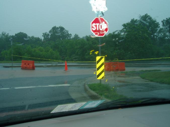
Ok, here's the cops blocking off Rt. 29/Stingfellow at 7-11:
And also look at this sidewalk ripped apart that is 10 feet above a stream.
And, this 3-TON steel reinforced concrete pipe is turned sideways and down the stream a bit. (before + after --red stripe on first is yardstick)
Attachments:


And also look at this sidewalk ripped apart that is 10 feet above a stream.
And, this 3-TON steel reinforced concrete pipe is turned sideways and down the stream a bit. (before + after --red stripe on first is yardstick)
Attachments:
Re: Flooding! [theres a river where my backyard should be]
Posted by:
06get em
()
Date: March 24, 2008 07:31PM
Damn!! the floods waters ripped all that shit up? thats pretty amazing. I love it and continue the great pics
Re: Flooding! [theres a river where my backyard should be]
Posted by:
Historian
()
Date: July 21, 2010 11:59AM
Wow I'm glad this was well documented! This flooding was positively the worst I've seen in my 40 years in Fairfax. Does anyone else have pics they can share from this event? I'll attempt to dig up my own as well. Thank you.
Re: Flooding! [theres a river where my backyard should be]
Posted by:
eesh
()
Date: July 21, 2010 12:06PM
LOL I remember going through this on Telegraph RD near Belvoir back then.
People were driving through the floods and at some points the water was at their door handles.
People were driving through the floods and at some points the water was at their door handles.
Re: Flooding! [theres a river where my backyard should be]
Posted by:
yes
()
Date: July 23, 2010 01:08PM
Global Warming.